RAF HARROWBEER
YELVERTON
Flying Over Harrowbeer
During the Summer of 2006, I was given the opportunity to fly over Harrowbeer to take some aerial views of the airfield as it is today. It is well known that over the course of a dry Summer, the markings of the taxi-ways and runways show as parch marks on the ground. I was also keen to experience at first hand what it must have been like to fly into Harrowbeer. Having only ever flown twice before (going to and from a holiday in France as a teenager!) I was excited about the prospect of an afternoon's flying anyway, and it was just a superb day! My thanks to Peter White for his patience in going round and round the airfield as I snapped away! Even so, I managed to miss some shots which I had planned to take!
So, fasten your seat belts and lets look at RAF Harrowbeer from the air.......
N.B. Click on the small picture to see a larger one.
|
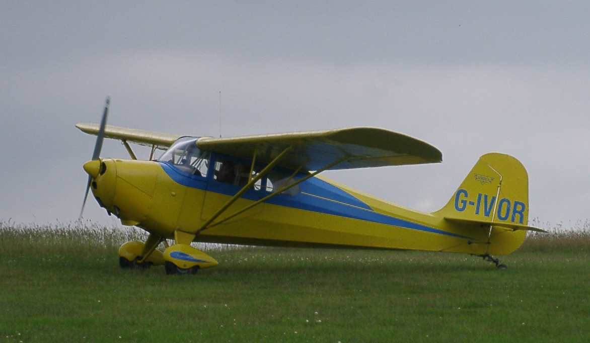
First things first! This is our aircraft, G-IVOR. Aeronca 11AC Chief (yellow) G-IVOR production aircraft, built Ohio,USA 1946. Pilot Pete White |
 |
 |
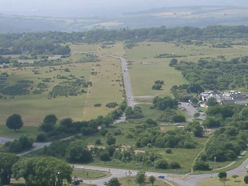
Runway 1 - (11/29) Approaching Harrowbeer from the West, this is the Crapstone end of the runway, with Yelverton at the far end. The 'stick' you can see is the top of the float in the fuel tank! This is/was Harrowbeer's longest runway at 1280 yds. |
|
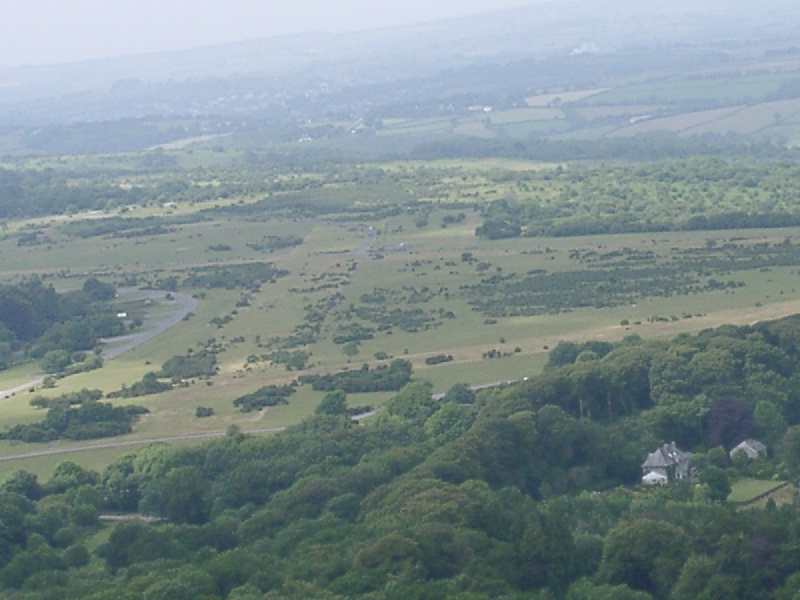
Runway 1- (11/29) Seen from the Yelverton end this time, (flying West). If you live locally, note how the current road actually runs up the edge of the former runway, before crossing it at Whistleigh. |
 |
 |
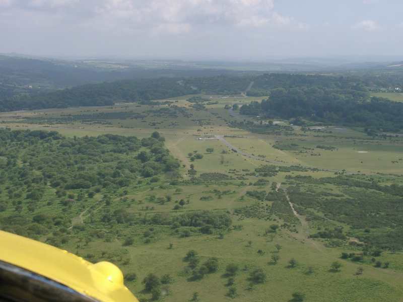
Runway 2 - (17/35) Approaching Harrowbeer from the South-East. We'd drifted right this time but the runway can be seen quite easily. The 'middle-sized' runway at 1115 yds long. |
|
Runway 2 - (17/35) Approaching Harrowbeer from the North-West. Again, we've drifted off line slightly. Note the taxi-way to the left of the runway. The white 'blob' on the right is the airfield's Compass Platform. |
 |
 |
Runway 3 - (05/23) Approaching Harrowbeer from the South. The runway is off to the right as we had drifted again. Knightstone Tea Rooms are clearly visible. The blur in the picture is the propellor! This was Harrowbeer's shortest runway at just 912yds long. Unfortunately I didn't get the corresponding shot from the other end. |
|
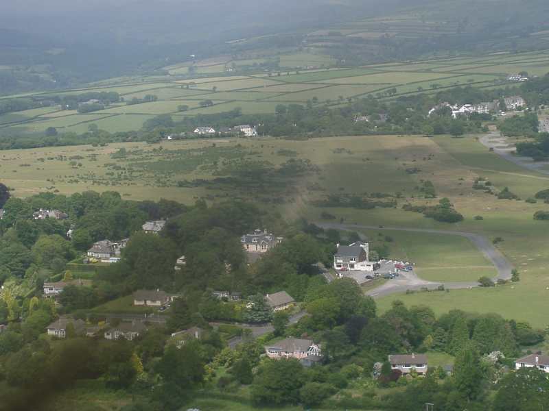
This area of the airfield was known as Tiffy Corner. The house is now called Brigadoon. It was taken over by the RAF for use on the airfield. From the bottom: The 'new' road put in by the RAF; Dispersal Bay - this is the one in the 'anfyfade' picture with a 312Sqdn Spitfire in it; Runway 11/29 'stain' with current Yelverton/Crapstone road; Various building bases including Bellman Hangar (back right) |
 |
|
I have some other shots taken on slide film which I'll try and scan in when I have time. My grateful thanks to Peter White, Pilot of G-IVOR for flying me over Harrowbeer and putting up with my 'Just round once more Peter!' requests!! he has suggested covering Bolt Head from the air too - which I'm up for! Stephen Fryer |