RAF HARROWBEER
YELVERTON
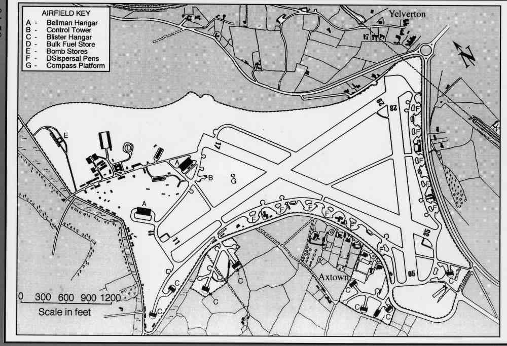
AIRFIELD MAPS
I am very grateful to the GMS Enterprises, the publishers of Airfield Focus (No 27) on Harrowbeer Airfield for permission to use the map on the back cover of the book. Whilst it is not a complete picture of what was on the airfield, it does give a good outline of the layout of Harrowbeer.
 |
We now offer for sale A3 & A4 size laminated prints of our interpretation boards. Currently you can only buy them from us at one of the events we attend.
 |
|
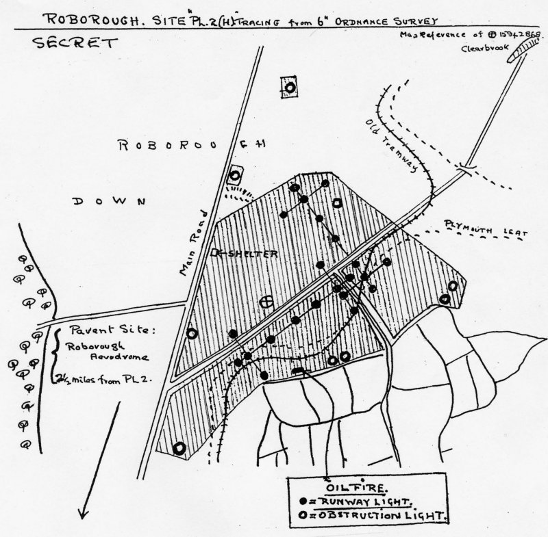
Map of Decoy Airfield |
Decoy Airfield near Clearbrook
The above map recently come to light. We have no idea who drew it or copied it, but it shows the plan of a decoy airfield that was laid out along the road between the A386 and the village of Clearbrook. My thanks to Dr Ian Bentley who discovered it.
More details of this 'find' can be found on the Miscellaneous page.